Iceland
Þingvellir (Thingvellir) National Park
- Forty kilometers northeast of Reykjavík, Þingvellir National Park protects a UNESCO World Heritage site combining extraordinary geological, historical, and cultural significance.
- The park sits in a rift valley where the North American and Eurasian tectonic plates diverge at 2cm annually—the only place on Earth where the mid-Atlantic ridge rises above sea level.
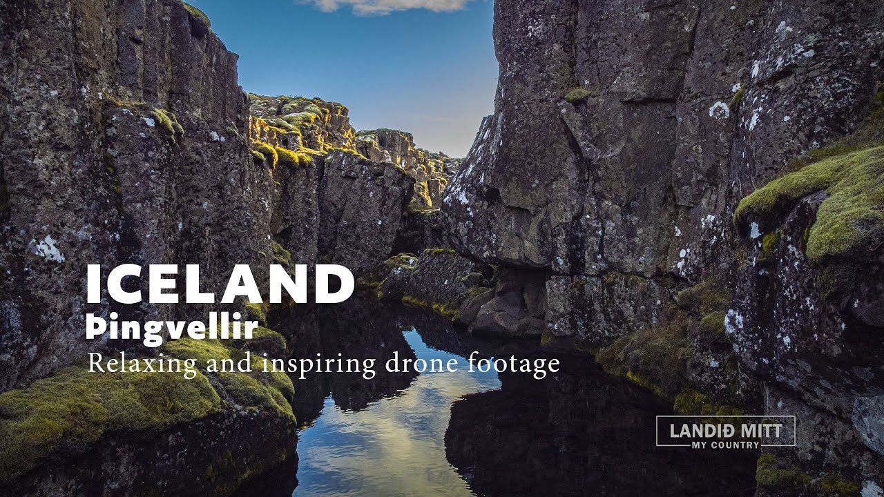
- Walking through Almannagjá gorge, you literally stand between continents—the dramatic stone walls on either side represent the plate boundaries slowly tearing Iceland apart.
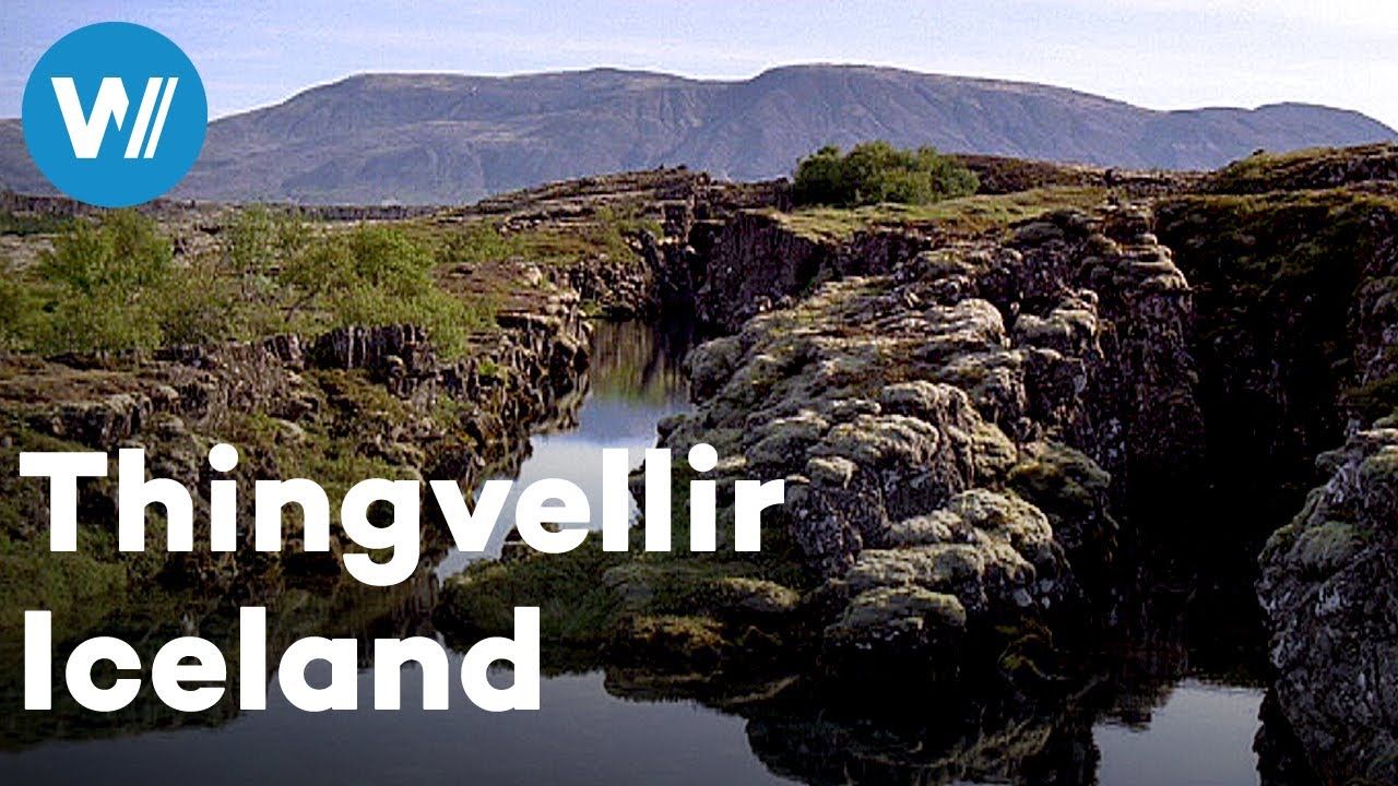
- The lava fields, created by eruptions over millennia, have weathered into moss-covered moonscapes dotted with cracks, fissures, and clear water-filled crevices (including Silfra, rated among the world's top dive/snorkel sites). Þingvallavatn, Iceland's largest natural lake, fills the southern portion—a glacial lake 84 square kilometers in area hosting unique Arctic char populations.
- The site's historical significance rivals its geology: Alþingi (Iceland's parliament) was established here in 930 CE, making it the world's longest-running parliament.
- For nearly 900 years (until 1798), Icelanders gathered at Þingvellir for two weeks annually to create laws, settle disputes, execute criminals, and celebrate marriages—the Law Rock (Lögberg) where the law speaker recited all laws from memory remains marked.
- The site represents the foundation of Icelandic national identity and democracy.
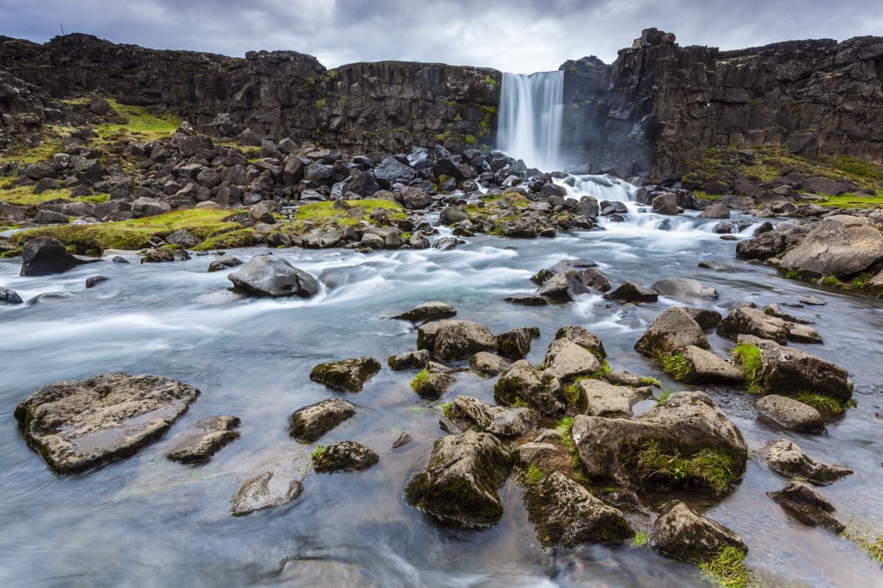
- The landscape feels primal: black lava carpeted in cushion-like moss, Öxarárfoss waterfall tumbling 20 meters into a basalt canyon, birch scrubland (Iceland's limited tree cover), and the overwhelming sense of geological forces at work.
- The Golden Circle tourist route—Iceland's most popular day trip from Reykjavík—includes Þingvellir alongside Gullfoss waterfall and Geysir geothermal area, making it accessible to 2+ million annual visitors.
- Despite crowds, the park's 237 square kilometers ensure finding solitude.
- Weather varies dramatically: summer midnight sun (bright until 11pm-midnight June-July), autumn northern lights, winter snow-covered dramatic beauty, spring wildflowers—each season transforms the landscape.
Watch it
Who Visits
- Golden Circle tourists (60%), divers/snorkelers (25%), hikers (10%), history enthusiasts (5%).
- Demographics extremely diverse—all ages, nationalities.
- Icelanders visit for historical/patriotic reasons; international tourists for geology/diving.
- Summer (June-August) brings midnight sun and peak crowds (10,000+ daily); winter (November-March) offers northern lights potential and solitude but harsh conditions; shoulder seasons (April-May, September-October) balance access and crowd management.
How to Get There
- Very Easy.
- From Reykjavík, drive Route 36 northeast (45 minutes, 48km, excellent paved road, free parking).
- Rental cars ($50-100/day) essential for Golden Circle independence.
- Alternatively, countless tour companies offer Golden Circle day tours ($50-100 per person, 8 hours, including Þingvellir, Gullfoss, Geysir, and sometimes additional stops).
- Public buses limited and inconvenient.
- The park's Visitor Center (Hakið) provides information, exhibits explaining geology/history, café, and toilets.
- Multiple parking areas (P1-P5) access different features—P1 and P5 most convenient for main sights.
- Park entry is free.
- Mobile coverage excellent.
- Medical facilities in Reykjavík (45 minutes).
- English universally understood.
- Accessible year-round though winter conditions require winter tires and awareness of darkness (4-5 hours daylight December-January).
- The park has paved walkways to main sights—largely accessible for mobility-limited visitors and families with strollers.
Best Time to Visit
- All visitors to Iceland (essential stop), geology enthusiasts, history buffs, divers/snorkelers (Silfra), photographers, families with children (safe, engaging, educational), elderly and mobility-limited (accessible paths), first-time Iceland visitors.
- The most accessible major geological site in Iceland—paved paths, short distances from parking, comprehensive information.
Risk & Safety
- LOW.
- Very safe, well-managed site.
- Silfra snorkeling/diving risks: Cold water causes discomfort and potential hypothermia if equipment fails (extremely rare with reputable operators); claustrophobia in narrow Big Crack section; panic from cold-water shock affecting breathing—operators screen participants carefully.
- Weather hazards: Icelandic weather changes rapidly—sudden storms, high winds, temperature drops; dress in layers, bring waterproofs.
- Slippery surfaces—wet lava rock and ice (winter) create fall risks; wear appropriate footwear.
- Remoteness—cell service good but weather can delay rescue; minor injuries more concerning in winter.
- Perfect for families with children 6+—safe walking paths, engaging geology/history.
- Largely accessible for elderly and mobility-limited—paved paths to main sights though some areas involve stairs/uneven surfaces.
- Silfra not appropriate for: pregnant women, individuals with heart/respiratory conditions, severe claustrophobes, children under 12 (snorkeling) or 17 (diving), those unable to fit dry suit parameters (operators provide sizing charts—check before booking).
Pictures (7)
Unique Experiences
- Silfra Snorkeling/Diving Between Continents: The Silfra fissure—a crack between tectonic plates filled with glacial meltwater filtered through underground lava for decades—offers 100-meter+ underwater visibility and opportunity to literally swim between North America and Eurasia. The water temperature (2-4°C year-round) requires dry suits (provided by operators, €140-180 for snorkeling, €220-300 for diving including gear). The 30-40 minute snorkeling tour floats you through three sections: Silfra Big Crack (narrow passage between walls), Silfra Hall (widening with azure depths), and Silfra Lagoon (shallow basin). The clarity is surreal—rock formations 40+ meters distant appear arm's reach away; sunlight penetrates creating cathedral lighting. The cold penetrates extremities (face, hands) despite dry suit—described as intense but manageable. Diving requires dry suit certification. Multiple operators (DIVE.IS, Silfra.is) lead tours daily. Requirements: Comfort swimming, ability to fit dry suit (height, weight, health restrictions apply), minimum age 12 (snorkeling) or 17 (diving). Winter brings unique appeal—snow-covered surroundings contrast underwater blue. Advance booking essential (weeks ahead in summer).
- Almannagjá Gorge Continental Divide Walk: The paved pathway descends through Almannagjá ("All Men's Gorge"), where 40-meter lava walls rise on either side—the most accessible demonstration of tectonic plate boundaries globally. Walk the 2km path (30 minutes leisurely, wheelchair accessible initially then steps) from parking to viewing platform overlooking Þingvallavatn lake and mountains. Information panels explain geological processes—the rifting, eruptions, and land subsidence. The gorge's scale and the knowledge that continents are literally pulling apart beneath your feet creates geological wonder. Continue to Öxarárfoss waterfall (10-minute walk from main path)—while small by Icelandic standards, the basalt columns and turquoise pool create photogenic scene. Summer wildflowers (Arctic thyme, dwarf willow) add color; winter ice transforms the canyon walls into crystalline formations.
- Law Rock (Lögberg) Historical Contemplation: At Almannagjá's base, a flagpole and plaque mark the approximate location of Lögberg—where Iceland's law speaker stood to recite memorized laws to gathered assembly. Stand here imagining 930-1798 CE gatherings—thousands of Icelanders traveling from across the island, setting up temporary camps (booths) visible in archaeological outlines, debating laws, resolving feuds, celebrating marriages, witnessing executions (drowning in Drekkingarhylur, a pool in Öxará river, for women and men accused of certain crimes—brutal but historically fascinating). The site represents the birthplace of Icelandic democracy and culture—Snorri Sturluson (medieval historian and poet) attended assemblies here. The Visitor Center's exhibition provides historical context with artifacts, reconstructions, and explanations enriching the contemplative experience.
- Þingvallavatn Lake Shore Exploration: The lake's northern shore offers trails away from main tourist concentrations. Walk or drive to smaller parking areas (P3, P4) accessing lava field trails, birdwatching sites (Arctic tern, great northern diver), and picnic spots with mountain/water views. The volcanic landscape—black lava with bright green moss, occasional birch scrub, crystal streams—feels otherworldly. The lake itself contains four unique Arctic char species found nowhere else (endemic), evolved in isolation—testament to evolutionary processes. The tranquility contrasts with crowded main visitor area—perfect for picnic lunches or contemplative walks. Trails range 2-10km, mostly easy terrain. Bring wind protection (Iceland's constant wind intensifies near open water).
- Northern Lights Viewing (Winter): September-March, when darkness returns to Iceland, Þingvellir's minimal light pollution creates excellent aurora viewing opportunities. On clear nights with geomagnetic activity, the northern lights dance above the lava fields and lake—green curtains, purple streaks, undulating waves. The dramatic geological landscape adds foreground interest to aurora photos. Tour operators offer evening northern lights tours ($50-100) including Þingvellir, or self-drive and wait at parking areas with other aurora hunters. Check aurora forecasts (Icelandic Meteorological Office app) and cloud coverage. Dress extremely warmly (temperatures -5 to -15°C, brutal wind chill). Patience required—auroras' timing is unpredictable, waits of 1-3 hours common. But when they appear above the rift valley, the combination is magical.